Weather Alert in Texas
Flood Warning issued April 29 at 8:41AM CDT until May 4 at 7:43AM CDT by NWS Norman OK
AREAS AFFECTED: Clay, TX; Wichita, TX
DESCRIPTION: ...The National Weather Service in Norman OK has issued a Flood Warning for the following rivers in Texas... Wichita River at Wichita Falls affecting Clay and Wichita Counties. * WHAT...Major flooding is forecast. * WHERE...Wichita River at Wichita Falls. * WHEN...From Wednesday morning to Sunday morning. * IMPACTS...At 22.0 feet, In Wichita Falls... extensive flooding occurs in Harrell and Lucy Parks. Flooding occurs in homes north of Third Street and in Tanglewood Hollow... and in Scotland Park. Flood depths up to 2 feet occur in an area north of Sixth Street and east of Scott Avenue. Agricultural areas upstream and downstream from Wichita Falls experience widespread flood depths up to 4 feet. * ADDITIONAL DETAILS... - At 7:45 AM CDT Tuesday the stage was 10.4 feet. - Bankfull stage is 18.0 feet. - Forecast...The river will fall to 9.8 feet this afternoon. The river is expected to rise above flood stage tomorrow morning to 22.5 feet tomorrow evening. - Flood stage is 18.0 feet. - Flood History...This crest compares to a previous crest of 22.7 feet on 06/04/1941. - http://www.weather.gov/safety/flood
INSTRUCTION: Stay tuned to further developments by listening to your local radio, television, or NOAA Weather Radio for further information. Turn around, don't drown when encountering flooded roads. Most flood deaths occur in vehicles. Additional information is available at www.weather.gov.
Want more detail? Get the Complete 7 Day and Night Detailed Forecast!
Current U.S. National Radar--Current
The Current National Weather Radar is shown below with a UTC Time (subtract 5 hours from UTC to get Eastern Time).

National Weather Forecast--Current
The Current National Weather Forecast and National Weather Map are shown below.

National Weather Forecast for Tomorrow
Tomorrow National Weather Forecast and Tomorrow National Weather Map are show below.

North America Water Vapor (Moisture)
This map shows recent moisture content over North America. Bright and colored areas show high moisture (ie, clouds); brown indicates very little moisture present; black indicates no moisture.

Weather Topic: What is Condensation?
Home - Education - Precipitation - Condensation
 Next Topic: Contrails
Condensation is the process which creates clouds, and therefore
it is a crucial process in the water cycle.
Condensation is the change of matter from a state of gas into a state of liquid,
and it happens because water molecules release heat into the atmosphere and
become organized into a more closely packed structure, what we might see as
water droplets.
Water is always present in the air around us as a vapor, but it's too small for
us to see. When water undergoes the process of condensation it becomes organized
into visible water droplets. You've probably seen condensation happen before on the
surface of a cold drink!
Next Topic: Contrails
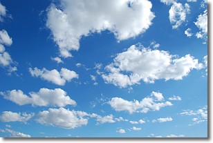
Weather Topic: What are Cumulonimbus Clouds?
Home - Education - Cloud Types - Cumulonimbus Clouds
 Next Topic: Cumulus Clouds
The final form taken by a growing cumulus cloud is the
cumulonimbus cloud, which is very tall and dense.
The tower of a cumulonimbus cloud can soar 23 km into the atmosphere, although
most commonly they stop growing at an altitude of 6 km.
Even small cumulonimbus clouds appear very large in comparison to other cloud types.
They can signal the approach of stormy weather, such as thunderstorms or blizzards.
Next Topic: Cumulus Clouds
Current conditions powered by WeatherAPI.com


